Bright and early. No,...dark and early. The only bright part was the angel, I guess! I woke up about 3:30am and was packed up and on the trail by 4:00. I was wearing a headlamp, and one of the funnier moments that morning was when I saw a couple of reflective dots out a ways on the side of the trail. At first, I was thinking, hmm I wonder what that sign's about. Then I was thinking, hmm I wonder who those eyeballs belong to! I was sure hoping the answer wasn't mountain lion!!!! With so many deer around (and road signs about mountain lions!), I was certainly aware of the possibility. But then I turned my head, and my headlamp lit up a bunch more eyeballs! It was a small flock of deer laying around in their pasture, no doubt wondering what the hell I was up to! (actually, they were probably totally used to us weird early hiker types, because just a few minutes later, when I looked back, I saw other headlamps behind me.

See? Again, never hiking alone, even when I'm going solo! This is not a bark scorpion - much bigger (4-6"). But he was a good boy (girl?) and sat still while I looked down on him with my headlamp and attempted to take a photo!

A lovely hanging garden.

The inner canyon section of the Bright Angel Trail stays shaded for a good part of the morning, which is a huge help and a big reason that most hikers ascend using this route. It's the upper part that is more exposed (although still shaded off & on) and likely to heat up first.

The trail leading to another set of zigzags, known as the Devil's Corkscrew.

Looking back at the Corkscrew.

A larger view, except that some of the rim is blown out so you can't see the top part.

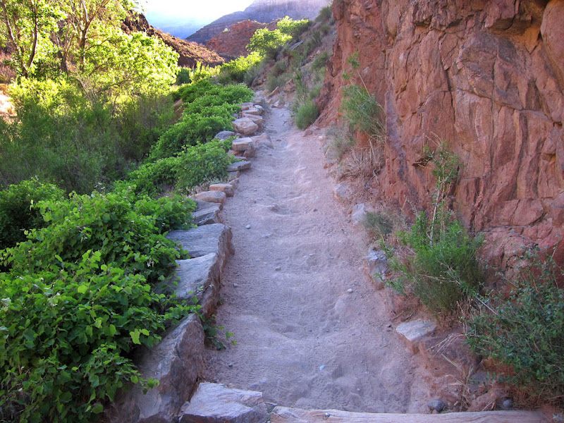
I thought maybe I'd already reached the Indian Gardens, this section was so green and pretty! (but I hadn't)

The sun breaking out and into this canyon groove, lighting up the treetops in this oasis.
Look at all the green! Vines growing all over. Amazing!


The trail runs along the rock ledges to the left of the creek/waterfall.

More neato agave stalks.

The trail is in deep shadow, but here you can see the rim, where the trailhead lies. I'm basically on the Tonto Plateau again and out of the inner canyon now. It's still nice and relatively cool - probably in the high 60s/low 70s?


It's so amazing to see these big green trees down here!

Cool flowers (gone to seed).

More of these vines taking over! I guess that's the power of shade and water - even in a desert canyon!

There was a sweet smell in the air for a large stretch of the trail, and the best I could figure, it was these vines! They didn't have a strong smell, but there were so many of them!

Looking up.

I'm sorry I couldn't squeeze in the deer's head quickly enough, but I wanted to show both her and the hiker.

Half-way!!! (well, a little over, I guess, but close enough)
I can't wait to get to that Toilet Water!!! :)

But seriously, I had finally reached the famed Indian Gardens (and the toilets). There's a windsock in the upper right - must be a helipad somewhere...

Datura.

Just past Indian Gardens, looking up. Hmm, a little ways to go yet...! And for me, this was definitely the hardest part. Much more exposed and much warmer, and up, up, up.

Looking back.

One of two rest houses on the way up (one is at 3 miles from the trailhead, and the other is 1.5 miles from it). There are also bathrooms and water at each of these stops. Hmm, wonder where they got the rock for these buildings... You almost can't see the building the rocks are such a perfect match for the cliff behind it!

Ah, a bathroom with a view!

The green oasis of Indian Gardens in the background, on the left. And the trail and a rest house on the right.

The rest house, zoomed in.

We've come a long ways, baby!! But we ain't there yet!

Getting close now! I could still remember the tunnel/arches from my ill-fated hike with Dad and Oma.

Indian Gardens, looking farther away and below!

There's the Kolb Studio! Almost to the top! About time!!! I've been dousing myself with water, and drinking and eating a lot, but I still have my usual too hot-too glary-too tired headache. That's OK, that's what they make ibuprofen for! It's worth it!!

And there it is - the photo I was looking for - the "after" picture!
DOWN: 7.4 miles to PR on South Kaibab, 4714 ft elevation loss, 5:30 to 11am with lots of photo stops!
UP: 9.9 miles from PR on Bright Angel, 4314 ft elevation gain, 4am to ~1:30pm with lots of photo stops (& it didn't help that I was at the point of having to constantly review my photos & delete in order to take more!!) & drenching stops!
= ONE TIRED BUT HAPPY HIKER!!! Woof! I'm soooo glad I got to do this hike. It was a really unique experience, and I really enjoyed it!
If you haven't had enough of hiking the Grand Canyon via the internet (somehow I doubt this is the case, but...), you can check out this guy's site: http://www.genehanson.com/c2003b/cany2003.htm His descriptions were entertaining and helped prepare me for the real thing.
No comments:
Post a Comment